![]()
![]()
This page is also available in French
![]()
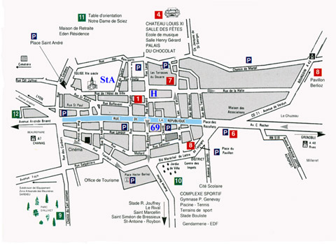
The street plan and road map of La Côte Saint-André are from a leaflet published and freely distributed by the Tourist Information Office at La Côte, originally prepared by Les Ateliers L. Palisse. The maps were adapted for this page to assist those of you who might wish to visit La Côte.
The road marked with light blue colour is the Rue de la République, and number 69 is the Musée Hector-Berlioz. StA indicates the location of the parish church of Saint-André, and H that of the Halles market.
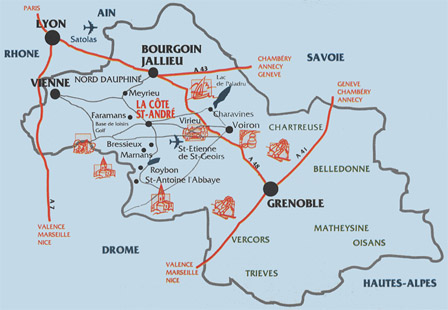
La Côte Saint-André can be reached by road from Grenoble and Lyon, which are both on the Paris-Lyon-Grenoble high-speed TGV main line railways. There is also a bus service to La Côte from Grenoble Bus Station (Gare Routière), located next to the Railway Station (Gare SNCF).

![]()
© Monir Tayeb and Michel Austin for the pictures and information on this page.
Copyright notice: The texts, photos, images and musical scores on all pages of this site are covered by UK Law and International Law. All rights of publication or reproduction of this material in any form, including Web page use, are reserved. Their use without our explicit permission is illegal.
![]() Back to La Côte Saint-André main page
Back to La Côte Saint-André main page